 Various organizations, including environmental activists, are leveraging satellite methane monitoring to report oil and gas operators to the U.S. Environmental Protection Agency (EPA) via the new Super Emitter Response Program (SERP). SERP was originally conceived as a regulatory initiative allowing private organizations certified by the EPA to identify and report large methane emission events, defined as 100 kg/hour (or about 129 mscfd), from oil and gas facilities. Although the EPA announced on July 28, 2025, that it had paused implementation of the SERP for 18 months due to “fundamental flaws” the agency found in the program, it provides insight into how satellite emissions monitoring has been envisioned and sets important benchmarks for future programs.
LEARN MORE: EPA Fact Sheet July 28, 2025
Climate change activists have championed satellite emissions monitoring as the solution for identifying large fugitive emissions events from oil and gas operations without the constraints of ground monitoring, which can result in trespassing and safety concerns. The SERP initiative was hailed by the Environmental Defense Fund (EDF) in a statement on its website, “While the U.S. Environmental Protection Agency implements its new methane rule to reduce emissions from leaks, flares and super-emitters, data from platforms like MethaneSAT can help monitor progress.”
Although SERP implementation has been delayed, it could be brought back either by the current administration, assuming the flaws are overcome, or by a future administration with a more aggressive regulatory stance. In any case, monitoring of oil and gas facilities by activist organizations comes with a variety of risks, including the potential for misattribution, exaggerated claims, and mistaken claims.
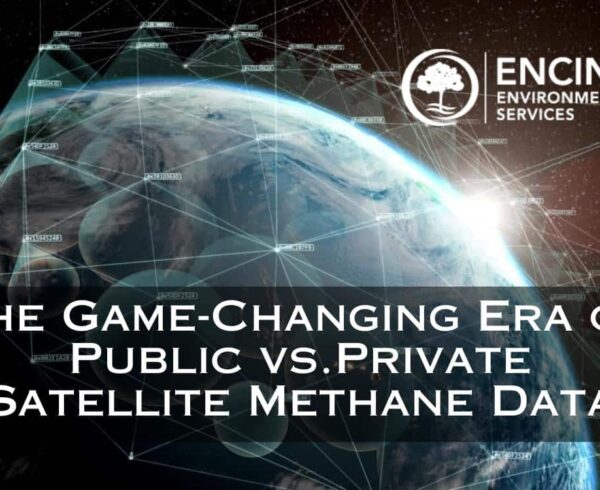
Lost in Space, But All Is Not Lost in Satellite Monitoring
MethaneSAT recently made headlines when it announced its mission operations had lost contact with its satellite. MethaneSAT is an Earth-observing climate satellite mission developed by the Environmental Defense Fund (EDF) in collaboration with the New Zealand Space Agency, Harvard University, and the Smithsonian Astrophysical Observatory.
In a press release, MethaneSAT acknowledged, “…the satellite has lost power, and that it is likely not recoverable.” Undeterred, the company further said, “EDF and MethaneSAT remain firmly committed to our core purpose of turning data into action to protect the climate, including reducing methane emissions from the global oil and gas industry.”
Although the MethaneSAT satellite may be lost, there are still at least seven known satellite missions currently operating:

Although MethaneSAT is no longer in service, several other missions are still in operation.
The Rise of Space-Based Monitoring: What’s Changed?
Historically, methane leak detection was limited to ground-based inspections, handheld infrared cameras (OGI), and periodic aerial surveys. These methods—while valuable—are limited in frequency and coverage, as well as costs. Satellite-based platforms like Satlantis, GHGSat, Carbon Mapper, and Sentinel-5P now offer daily or near-real-time data, identifying methane plumes from hundreds of miles above Earth with increasing resolution and accuracy.
The implications for energy operators are significant:
- Near-instantaneous detection of large leaks (typically >100 kg/hr).
- By defining what qualifies as a “super emitter” event, the SERP laid the groundwork for consistent satellite emissions monitoring.
- Third-party validation of emission events outside of operator control.
- Greater regulatory pressure to act quickly and transparently.
As noted above, on July 28, 2025, the EPA suspended the SERP for 18 months making these implications irrelevant. Although paused, the initiative could be reinstated as part of future emissions oversight efforts.
Even with the SERP on hold, satellite-based monitoring of methane emissions persists, revealing plumes and other events. While the EPA has no current mandate to respond, these reports can nonetheless create reputational and political pressures.
Some oil and gas producers are taking a proactive approach to satellite-based emissions monitoring. On September 3, 2025, GHGSat announced a partnership with ExxonMobil to track and mitigate methane across the company’s onshore operations in North America and Asia, including the United States, Canada, Papua New Guinea, and Indonesia. Collaborations like this give companies a global, real-time view of their emissions, enabling faster response and more effective mitigation. They also send a strong signal to investors and stakeholders that the company is serious about environmental responsibility and operational transparency.
READ MORE: GHGSat to Provide Methane Monitoring for ExxonMobil
Understanding the EPA’s Super Emitter Response Program (SERP)
In its Oil & Gas Fact Sheet of July 28, 2025, the EPA wrote, “The EPA has determined that there are fundamental flaws in the 2024 rule’s ‘super emitter’ program that have affected the program’s implementation and the Agency’s review and processing of submitted data extension of the deadline.
Although the EPA has pushed back implementation of the SERP by 18 months, effectively until 2027, there is nothing preventing activists from publicizing data on emissions events today.
In fact, several satellite missions continue to report on emissions activity.
In its current form, albeit on pause, the SERP requires the EPA to use verified third-party data—including satellite observations—to identify large methane emission events. Once detected:
- The EPA notifies the operator.
- The operator has 5 days to conduct an investigation.
- The operator must submit findings and corrective actions within 15 days.
- If no action is taken, enforcement may follow—and the event becomes public record.
Whether the program is significantly defanged or scrapped altogether remains to be seen.
READ MORE: Understanding the Super Emitter Response Program: A Proactive Approach to Emissions Management
Activist Pressure and Legal Exposure
Regardless of the status of the SERP, environmental advocacy groups are highly motivated to use satellite data to drive public campaigns, investor pressure, and legal challenges. Even without a federal program mandating how satellite data is communicated and how operators respond, Energy producers may find themselves in the headlines—or in court—due to methane detections that may be:
- Misattributed to their operations
- Exaggerated in scope or cause
- Caused by adjacent or third-party sources
Having the ability to proactively verify, contextualize, and respond to these claims is critical for maintaining operational integrity and stakeholder trust.
How Encino Environmental Protects Oil and Gas Operators
Encino Environmental offers a full suite of emissions detection, verification, and compliance services tailored to help operators stay ahead of SERP requirements and guard against activist-driven claims.
READ MORE: Encino’s EmSAT™ Satellite Methane Detection System
Why EmSAT? Three Key Differentiators
1. Infrared Sensor Sensitivity and Resolution
EmSat, Encino’s branded satellite monitoring service provided by Satlantis, boasts a next-generation infrared sensor that is nearly three times more sensitive than existing satellites on orbit providing Ultra High image resolution. With a pixel resolution of approximately 13 meters, compared to other satellites’ pixel size of 25-30 meters, EmSat can detect methane concentrations—allowing operators to spot, source allocate, and fix leaks faster, often before they become operational or regulatory issues or even public news.
This level of detail means that even emissions from individual well pads or smaller compressor stations can be identified and quantified with precision, giving companies a major advantage in monitoring their environmental footprint.
The photo below illustrates the difference between standard resolution (on the left) and Ultra High imaging (on the right).
The Satlantis/EmSat satellite provides two spectra of imaging: (a) Infrared and (b) Visible. The images below demonstrate the significant difference between standard Visible image resolution and the Ultra-High resolution available with Satlantis.
READ MORE: Pioneering Satellite-Based Methane Leak Detection Solutions Through Strategic Partnerships

2. Pan and Tilt Imaging System
Unlike conventional satellites that only look straight down (nadir view), EmSat includes an Agility Feature that basically allows the system to pan and tilt, enabling the sensor to angle toward specific sites. This capability dramatically improves revisit rates—allowing EmSat to monitor a facility up to three times a month, compared to roughly once a month or once every 15-20 days for most static-orbit satellites.
This agility is particularly valuable for:
- Monitoring high-risk or high-priority assets more frequently
- Verifying repairs or mitigation actions post-incident
- Creating continuous emissions baselines over time
3. Mission-Tasking and Control
Because Encino operates EmSat, we have full control over its mission tasking. That means we can assign the satellite to follow specific infrastructure — such as tracking a pipeline route, monitoring specific high-emitting facilities, or conducting ongoing surveillance of suspected hotspots.
This capability provides oil and gas operators with tailored, client-specific monitoring that no general-purpose public satellite can match.
READ MORE: Advances in Satellite Methane Monitoring – The Best Defense is a Good Offense
– Satellite Data Reconciliation and Event Attribution.
Encino combines satellite emissions datasets with on-the-ground monitoring to provide clients with independent validation of reported events. We help determine:
- Whether the leak originated on your site
- The magnitude of emissions using validated methods
This forms the foundation of an affirmative defense in both regulatory and public forums.
– Continuous Monitoring Solutions.
Encino deploys fixed OGI cameras to complement satellite data with high-resolution local context. These tools provide:
- Very low detection threshold (lower than the 1 kg/hr regulatory threshold).
- Early warning of leaks—before satellites detect them
- Empirical emissions quantification
- Compliance documentation
– Regulatory Reporting Support.
Now that the EPA has delayed implementation of the SERP program, we will be monitoring the program’s evolution and updating our guidance to clients.
– Litigation and PR Risk Mitigation.
Encino equips clients with fact-based evidence to counteract unfounded environmental claims from third parties. This includes:
- Source apportionment analysis
- Emissions modeling
- Environmental forensics and chain-of-custody documentation
– Methane Intensity Benchmarking and ESG Reporting.
In parallel, Encino helps operators track their emissions performance over time and benchmark against peers—supporting voluntary commitments like OGMP 2.0, API’s ESG Reporting Framework, and net-zero goals.
Proactive Compliance Is the Best Defense
In today’s hyper-transparent environment, methane leaks are no longer invisible, and neither are your efforts to manage them. Environmental activists remain committed to leveraging satellite data to pressure Energy producers, however, without independent information operators are at risk of inaccurate, exaggerated, and misattributed claims. As a result, industry must shift from a reactive mindset to a proactive emissions strategy, using technology and data to stay in front of satellite detection and regulator action.
Encino Environmental offers technical expertise, tools, and strategic insight to help you stay compliant, stay credible, and stay in control.
Contact us today to learn how to put EmSat to help you mitigate risks and achieve environmental performance that generates economic results.